UPDATE: A sudden cold snap has gripped Brainerd, Minnesota, with temperatures plummeting to around 14°F and expected to drop further as blizzard conditions are forecast for the area. Following a week of mild and foggy weather, the drastic shift began on Sunday, December 28, 2023, bringing freezing fog, blowing snow, and dangerous wind gusts up to 28 mph.
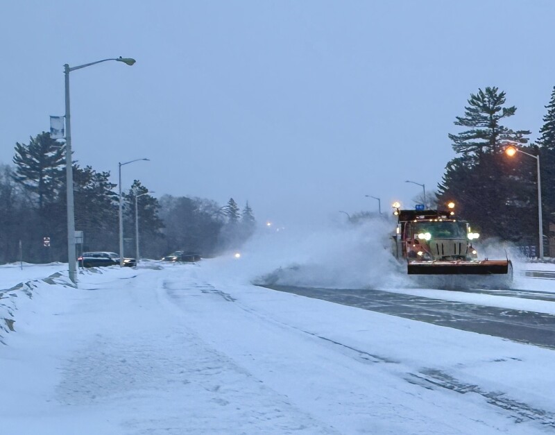
The National Weather Service warns of localized whiteouts and hazardous driving conditions as winds continue to intensify. Areas south and west of Crow Wing County are bracing for heavier snowfall, with initial predictions of 7 inches now revised down to 3-4 inches for Brainerd, Baxter, and much of Crow Wing, Aitkin, and Cass counties.
Todd County remains under a blizzard warning, while Morrison and Mille Lacs counties are experiencing winter storm warnings. By 5 p.m. Sunday, approximately 3 inches of snow had already blanketed the Brainerd area. The storm is expected to taper off by 3 a.m. Monday.
Wind chills are forecast to plunge to a dangerous -20°F late Sunday into Monday, prompting officials to advise against unnecessary travel. As the cold front moves in, residents can expect wind gusts reaching as high as 50 mph overnight.
Looking ahead, Monday will bring a brief respite with sunshine, but temperatures are not expected to rise above 5°F. Wind gusts will make it feel even colder, dropping below zero overnight. Those planning errands may want to wait until Tuesday, when temperatures could reach a more bearable 30°F with a 20% chance of snow before noon.
As Brainerd rings in the New Year, residents should prepare for a continued cold snap. New Year’s Eve will see a high near 9°F and a low around -6°F. New Year’s Day promises sunny skies with a high of only 7°F and a wind chill of approximately -20°F.
This urgent weather update serves as a reminder for residents to stay safe and informed as conditions rapidly change. The community is urged to monitor local forecasts and take precautions against the extreme cold and potential blizzard conditions.