Severe weather experts warn a major outbreak with potential for historic tornado activity is rapidly developing across the Great Plains and stretching into the Great Lakes region as May nears its end. The latest forecasting models, including the highly regarded Euro Ensemble, are signaling a pattern reminiscent of the devastating 2004 tornado season.
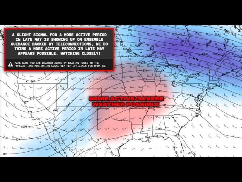
The Euro Ensemble Model is highlighting a classic atmospheric setup known as a trough-ridge pattern, which meteorologists recognize as a powerful driver of widespread severe thunderstorms and tornadoes. This is expected to create favorable conditions for intense storm activity, including long-track tornadoes, spanning from the central and southern Plains northeast toward the Great Lakes corridor.
Forecasters explain the trough-ridge configuration concentrates wind shear, moisture, and atmospheric instability — all crucial ingredients for explosive storm development. The model’s 500 mb wind analysis run earlier this month confirmed an increasing likelihood of this setup solidifying through late May and into June.
The potential scale of this outbreak is alarming. Experts draw a direct comparison to the 2004 tornado season, known for its persistent and violent tornado activity that struck states across the central U.S. If these indications hold true, communities stretching from the Great Plains through the Mississippi Valley and up into Ohio’s region could face heightened risk well into June.
Meteorologists caution that long-range forecasting naturally holds uncertainty, but the consistency of signals in repeated model runs is enough to warrant urgent public alertness. “The pattern emerging is exactly what we saw in 2004 when tornado activity surged to historic levels,” said a leading meteorologist monitoring the situation.
With this unfolding threat, residents across Ohio, neighboring states, and the broader Midwest should prepare now. Officials urge people to review severe weather safety plans, ensure their weather alert systems are working, and stay tuned to the latest local forecasts as this critical period approaches.
Experts stress the importance of vigilance: “This could quickly become a very dangerous stretch for several states,” said storm safety advocates. “Being prepared and informed in the coming days is absolutely essential.”
The increasing threat is expected to have significant implications for public safety as the tornado season ramps up across these vulnerable regions. Emergency management teams in Ohio and surrounding areas are already ramping up readiness efforts to respond to possible severe storm impacts.
For continuing updates on this developing severe weather threat, as well as detailed storm forecasts and safety resources, stay connected to The Ohio Observer and trusted national weather authorities.