UPDATE: A powerful storm fueled by an atmospheric river is set to impact the Pacific Northwest this weekend, bringing heavy rainfall and mountain snow just in time for the Thanksgiving Week. The National Weather Service warns of potential localized flooding from Medford, Oregon, to Spokane, Washington, with conditions expected to worsen as the storm moves in.
Showers will begin hitting the Seattle metro area on Saturday, quickly spreading southward to Eugene and Portland by Saturday night. Travelers should prepare for reduced visibility and possible delays during this busy pre-holiday weekend. The heaviest rain is forecasted for Thanksgiving morning, especially from Seattle to Portland, with the storm advancing inland later in the day.
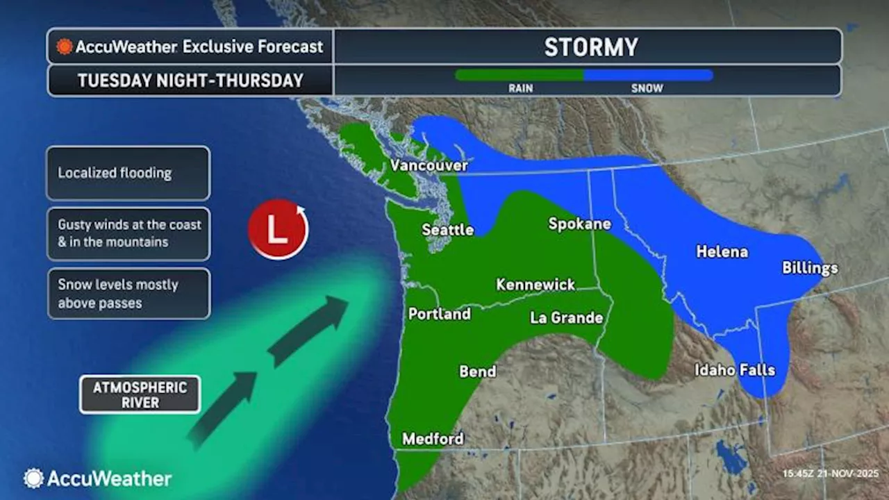
According to AccuWeather’s meteorologist Joe Lundberg, Monday may provide a brief respite from the rain, creating a potential window for holiday travel. However, the calm will be short-lived as rain is expected to become more widespread on Tuesday and Wednesday, coinciding with the arrival of the atmospheric river.
Gusty winds will accompany the storm, particularly along the coasts and in higher elevations. Residents are advised to secure outdoor holiday decorations to prevent damage from strong gusts. With a cold front pushing south from British Columbia, accumulating snowfall is predicted across the highest peaks in northeastern Washington, northern Idaho, and western Montana.
While several inches of snow are likely at higher elevations, major travel routes should remain passable, as snow levels are expected to stay above heavily traveled passes.
Authorities urge residents to stay informed on evolving weather conditions as the storm progresses, especially those planning to travel during the Thanksgiving holiday. Public safety announcements will be updated regularly as the situation develops.
Stay tuned for further updates and prepare for challenging weather conditions this Thanksgiving as the atmospheric river approaches.