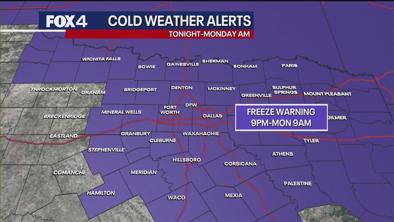
URGENT UPDATE: A Freeze Warning is now in effect for nearly all of North Texas, starting at 9 p.m. Sunday and lasting until 9 a.m. Monday. The National Weather Service has escalated the previous Freeze Watch to a formal warning as the coldest air of the season sweeps into the region.
Residents are urged to take immediate precautions: Protect vulnerable plants, bring pets indoors, and dress in multiple layers if you must venture out tonight or early Monday morning.
The sharp drop in temperatures is attributed to strong northerly winds, with sustained gusts between 15 and 25 mph, and gusts potentially reaching up to 30 to 35 mph later today. Today’s high is expected to be just shy of 60 degrees, but the wind will make it feel even colder.
Overnight, temperatures are forecasted to plunge near or below the freezing mark of 32 degrees in the immediate Metroplex, while outlying areas like Denton and Collin Counties could see lows dipping into the upper 20s. With the intense winds projected to continue through Monday morning, “feel like” temperatures in many locations will hover in the upper 20s and low 30s, with some areas experiencing chills as low as the mid-20s.
This brief cold snap will be short-lived. Forecasts indicate that high pressure moving in from the west will shift to southerly flow by Tuesday, driving temperatures back up significantly. By late this week, highs are expected to rebound into the mid to upper 70s, with some areas potentially reaching the low 80s over the weekend.
Additionally, there is a low chance of rain and thunderstorms in the forecast for next weekend, making it crucial for residents to remain alert and prepared for rapid changes in weather conditions.
Stay tuned for further updates, and ensure your home and loved ones are protected from this sudden cold front!