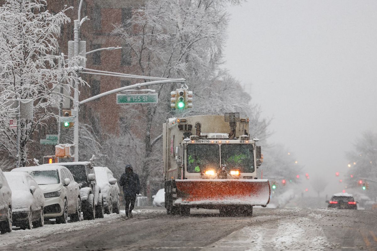
UPDATE: Approximately 72 million Americans are bracing for severe winter weather as powerful winds and snowstorms threaten to disrupt holiday travel plans. A massive weather system is sweeping eastward from the High Plains and Rocky Mountains to the Northeast, with wind gusts expected to reach up to 60 mph in some regions.
The most intense gusts will impact areas across Appalachia, New England, and coastal Maine. Communities from Washington, D.C. to Boston are already experiencing rain and wind, and disruptions are expected to escalate throughout the evening.
Travelers on the West Coast, particularly in California, should prepare for significant disruptions from this weekend through Christmas week. After recent storms battered the Northwest, California is set to face heavy downpours, which could trigger urban flooding and overflows in small streams. AccuWeather warns that lower and mid-level areas may see several inches of rain, with the highest totals falling along west- and southwest-facing mountain slopes.
Airports across the Northeast are likely to face delays as adverse weather conditions, including lake-effect snow, blanket the region. According to AccuWeather Senior Meteorologist Adam Douty, “A somewhat larger clipper storm will affect parts of the Upper Midwest and Northeast from Monday to Tuesday,” with Tuesday shaping up to be the most challenging day for weather-related travel disruptions in the Northeast.
In the Sierra Nevada and Cascades, multiple feet of snow are expected at higher elevations, complicating travel plans. AccuWeather Chief On-Air Meteorologist Bernie Rayno noted, “Snow levels will dip to pass levels at times, which can impede travel.”
While this weekend’s weather outlook appears calmer aside from lingering winds and snow in the Great Lakes area, states avoiding the wintry blast are projected to experience one of the warmest Christmases on record. Temperatures may soar into the 70s and 80s Fahrenheit from Texas to Missouri and Georgia, potentially shattering daily records on both Christmas Eve and Christmas Day.
New Yorkers anticipating a festive snowy holiday may be disappointed, as December 25 is expected to be dry and mild with temperatures in the mid-40s. Although there is a chance for light snowfall early next week, meteorologist John Feerick states, “Even if we were to get a small accumulation, it would melt by the time we got to Christmas.”
Historically, a white Christmas in New York City is quite rare, with the last substantial snowfall occurring in 2002. Feerick emphasized, “Only six times in the last 156 years has New York City had over an inch of snowfall on Christmas Day.”
As millions prepare for holiday travel, the combination of severe winter weather and potential record-breaking warmth poses significant challenges across the nation. Stay tuned for further updates as this situation develops.