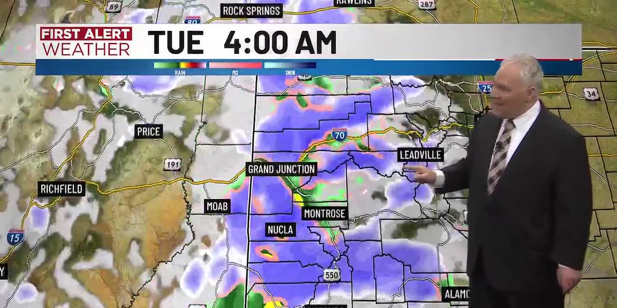
URGENT UPDATE: A significant winter storm is impacting Western Colorado, with travel disruptions expected starting Tuesday and lasting through the week. Heavy snow in the mountains and rain in the valleys are predicted, creating dangerous travel conditions on major routes from the Western Slope to the Front Range.
A Winter Storm Warning is in effect from 11 PM Monday until 5 AM Thursday for numerous mountainous areas, including the Grand Mesa, Uncompahgre Plateau, and San Juan Mountains. Travelers should prepare for up to 18 inches of snow in higher elevations, with wind gusts reaching 60-70 mph, reducing visibility to near zero.
“Travel through the mountains could be difficult to impossible due to these severe weather conditions,” officials warn.
This winter storm could severely impact travel toward Metro Salt Lake City, with additional disruptions expected for areas such as Vail Pass, Telluride, and Snowmass. Snowfall is anticipated to be heaviest in the Elk Mountains, where localized totals could exceed 3 feet by midday Wednesday.
A Winter Weather Advisory is also in effect for the Roan and Tavaputs Plateaus in northwestern Colorado and eastern Utah, predicting 4-10 inches of snow along with wind gusts up to 60 mph. Travel will be challenging here as well.
Additionally, a Wind Advisory is active for much of Southwest and Northwest Colorado from 5 AM Tuesday until 5 PM Tuesday, with gusts up to 50 mph reported across the Yampa River Basin, Paradox Valley, and other regions.
The storm will unfold in waves. Rain and snow are expected to start late Monday night, with significant accumulation beginning Tuesday. Areas of snow will increase overnight, and another wave of precipitation is forecasted for Wednesday morning.
Travelers are urged to remain vigilant and consider postponing travel plans during this period. Authorities emphasize the need for caution as conditions may rapidly deteriorate.
Current forecasts suggest that parts of the region could see 1-2 feet of snow by Wednesday with additional snowfall on Thursday and Friday before clearer conditions return for the weekend.
As this storm progresses, stay tuned for updates and heed local advisories for your safety.