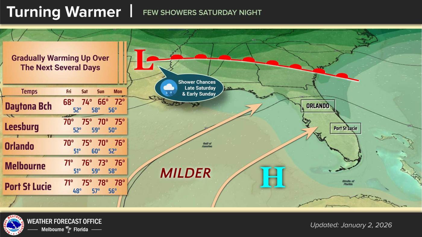
URGENT UPDATE: Central Florida is experiencing a significant warm-up today, with temperatures expected to reach around 70°F this afternoon. The National Weather Service in Melbourne reports that this warming trend will continue into Saturday before a cold front moves through the Southeast U.S., bringing a slight temperature drop and a chance of rain.
As high pressure drifts east across the Florida peninsula, residents can enjoy dry conditions today with light westerly winds. Overnight lows will climb into the upper 40s, although some rural areas south of I-4 could see temperatures dip into the mid 40s.
The cold front is associated with a trough passing through the Tennessee Valley, and forecasters anticipate an increase in southwesterly winds, reaching speeds of 10-15 mph in the afternoon, with gusts approaching 20 mph north of I-4.
Most of Saturday is expected to remain dry, but cloud cover will increase overnight, setting the stage for the incoming front. Saturday will see highs in the mid 70s, but temperatures will cool slightly as the front approaches.
According to the National Weather Service, “the front will pass through the area Saturday night into Sunday, bringing scattered showers.” Sunday’s temperatures are predicted to stay in the 70s for much of the region, while areas north of I-4 may cool to the upper 60s with overnight lows dipping into the 50s.
Looking ahead, the beginning of next week is forecast to bring even warmer temperatures with mostly dry conditions. Highs could reach the upper 70s to lower 80s by Thursday, while overnight lows will generally remain in the 50s, with coastal areas staying in the lower 60s.
Stay tuned for further updates as the weather situation develops. Residents are advised to prepare for potential rain as the weekend progresses.